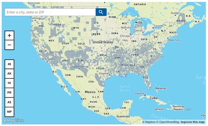
The U.S. Council on Environmental Quality (CEQ) has released a beta version of the Climate and Economic Justice Screening Tool. CEQ created the mapping tool in response to Executive Order 14008, Tackling the Climate Change at Home and Abroad.
How it works
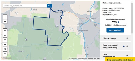
The tool uses Census tracts to identify disadvantaged communities. Disadvantaged Census tracts rank above the threshold for one or more environmental indicators and above the threshold for an economic indicator.
The tool’s climate and economic indicators use nation-wide, publicly available data. They include the following:
- Climate change
- Clean energy and energy efficiency
- Clean transit
- Affordable and sustainable housing
- Reduction and remediation of legacy pollution
- Critical clean water and waste infrastructure
- Health burdens
- Training and workforce development
Why it matters for rural and small metro regions
CEQ created the Climate and Economic Justice Screening Tool to help Federal agencies identify communities that are “marginalized, underserved, and overburdened by pollution,” according to the tool’s website. However, the tool can also be useful to other types of users. For instance, regional transportation decision-makers and planners could look at potential impacts in areas where transportation projects are under consideration. As a result, using this tool might benefit transportation organizations that consider environmental, community, and economic impacts early in the transportation planning process through Planning Environment Linkages (PEL).
Since the tool is in beta form, CEQ will gather feedback through listening sessions on March 22 and April 15, 2022.
Find the tool at https://screeningtool.geoplatform.gov/en/.
Find other information and resources on PEL related to rural transportation here, and the Federal Highway Administration has many more resources on PEL here.